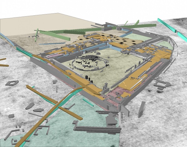
Geographic Information Systems (GIS) have revolutionized the field of surveying, providing powerful tools for data collection, analysis, and visualization.
By integrating spatial data with various forms of information, GIS enhances the accuracy and efficiency of surveying processes.
This article explores how GIS is transforming surveying practices, improving data accuracy, and providing innovative solutions to traditional challenges.
Understanding GIS in Surveying
GIS is a framework for gathering, managing, and analyzing spatial and geographic data. In surveying, GIS integrates data from various sources, such as satellite imagery, aerial photography, and GPS, to create comprehensive maps and models.
This capability enables surveyors to visualize relationships, patterns, and trends in spatial data, facilitating informed decision-making.
Key Components of GIS
- Data Acquisition: The first step in GIS is data acquisition, which involves collecting spatial data from various sources, including:
- Satellite imagery
- Aerial surveys
- Ground-based surveys using GPS and total stations
- Data Management: Once data is collected, it needs to be organized and stored in a GIS database. This process involves data cleaning, integration, and transformation to ensure consistency and accuracy.
- Data Analysis: GIS allows for advanced spatial analysis, enabling surveyors to perform operations like overlay analysis, buffering, and spatial interpolation. These analyses help identify relationships and make predictions based on spatial data.
- Data Visualization: One of the most powerful features of GIS is its ability to create maps and visual representations of data. These visualizations make complex information more accessible and understandable, aiding in communication and collaboration among stakeholders.
Enhancing Data Accuracy with GIS
1. Improved Data Collection Techniques
Traditional surveying methods can be time-consuming and prone to errors due to human factors. GIS enhances data collection through the use of modern technologies such as:
- GPS Technology: High-precision GPS devices enable surveyors to obtain accurate location data, reducing the margin of error significantly.
- Remote Sensing: Satellite and aerial imagery provide a broader perspective of the area being surveyed, capturing information that may be difficult or impossible to obtain on the ground.
2. Integration of Multiple Data Sources
GIS enables the integration of diverse data sources, leading to a more comprehensive understanding of the surveyed area. For example, surveyors can combine:
- Topographic maps
- Land use data
- Soil types
- Infrastructure information
This multi-layered approach allows for cross-verification of data, enhancing its accuracy and reliability.
3. Spatial Analysis Capabilities
GIS provides robust analytical tools that enhance the accuracy of survey results. For instance:
- Overlay Analysis: Surveyors can overlay different data layers to identify relationships and patterns, ensuring a more thorough understanding of the spatial context.
- Statistical Analysis: GIS allows for the application of statistical methods to spatial data, helping to identify trends and anomalies that may indicate inaccuracies.
4. Real-Time Data Updating
GIS can incorporate real-time data from various sources, allowing surveyors to make immediate updates to their datasets. This capability is particularly useful in dynamic environments where conditions can change rapidly, ensuring that survey data remains current and accurate.
5. Error Detection and Correction
GIS systems can be programmed to identify potential errors in the data. For example, discrepancies in elevation data or inconsistencies in land use classifications can be flagged for review. This automated error detection reduces the likelihood of inaccuracies in final survey outputs.
Applications of GIS in Surveying
1. Urban Planning and Development
GIS plays a crucial role in urban planning, helping surveyors assess land use, zoning regulations, and infrastructure needs. By providing accurate spatial data, GIS supports sustainable development and efficient resource allocation.
2. Environmental Management
Surveyors use GIS to analyze environmental data, monitor changes in land use, and assess the impact of human activities on ecosystems. This capability is essential for conservation efforts and regulatory compliance.
3. Transportation Planning
GIS enhances transportation surveying by analyzing traffic patterns, road networks, and accessibility. Accurate data enables planners to make informed decisions about transportation infrastructure and improvements.
4. Utilities and Infrastructure Management
GIS is invaluable in managing utilities such as water, electricity, and telecommunications. Surveyors use GIS to map existing infrastructure, plan for expansions, and optimize service delivery.
Challenges and Considerations
While GIS offers numerous benefits for surveying, several challenges must be addressed:
- Data Quality: The accuracy of GIS outputs is highly dependent on the quality of the input data. Ensuring high-quality data collection and management is crucial.
- Training and Expertise: Effective use of GIS requires trained professionals who can navigate the complexities of the software and interpret the results accurately.
- Cost: Implementing GIS technology can be expensive, especially for small surveying firms. However, the long-term benefits often outweigh the initial investment.
Conclusion
Geographic Information Systems (GIS) are transforming the field of surveying by enhancing data accuracy, efficiency, and decision-making capabilities.
Through improved data collection techniques, integration of diverse data sources, and advanced analytical tools, GIS provides surveyors with the means to deliver more accurate and reliable results.
As technology continues to evolve, the role of GIS in surveying will only grow, making it an essential component of modern surveying practices.
By embracing GIS, surveying professionals can better meet the challenges of an increasingly complex world and contribute to more sustainable and informed decision-making.
Also Read
The role of surveying in infrastructure development: A comprehensive guide
How LiDAR technology is transforming the surveying landscape

