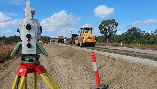
Infrastructure development is a critical component of economic growth and societal advancement, providing the backbone for transportation, utilities, and urban expansion.
Among the key disciplines that facilitate effective infrastructure development is surveying.
This article provides a comprehensive overview of the vital role surveying plays in infrastructure projects, covering various aspects such as types of surveys, technologies used, the surveying process, and its impact on project success.
Understanding Surveying in Infrastructure Development
Surveying is the science of measuring distances and angles on the Earth’s surface to determine land and property boundaries. In infrastructure development, surveying is crucial for collecting data that informs design, construction, and maintenance decisions.
It ensures that projects comply with legal, environmental, and safety standards.
Types of Surveys in Infrastructure Development
- Topographic Surveys: These surveys capture the terrain’s features, including contours, vegetation, and existing structures. Topographic data is essential for designing roads, bridges, and buildings, helping engineers understand the land’s physical characteristics.
- Boundary Surveys: These surveys establish property lines and legal boundaries. They are crucial in avoiding disputes and ensuring that infrastructure projects do not encroach on neighboring properties.
- Construction Surveys: Conducted during the construction phase, these surveys provide precise measurements to guide construction activities. They ensure that structures are built according to design specifications and are aligned correctly.
- Geodetic Surveys: These surveys involve measuring large areas of the Earth’s surface, often using advanced technologies like GPS. Geodetic surveys are vital for large infrastructure projects, such as highways and railways, where accurate alignment over long distances is required.
- Hydrographic Surveys: These are conducted to measure and describe the physical features of bodies of water. Hydrographic surveys are essential for projects involving bridges, docks, and other waterfront structures.
Technologies Used in Surveying
Modern surveying employs a range of advanced technologies that enhance accuracy and efficiency:
- Global Positioning System (GPS): GPS technology provides precise location data, enabling surveyors to determine exact coordinates and elevations for infrastructure projects.
- Total Stations: These instruments combine electronic theodolites and distance measuring devices, allowing surveyors to measure angles and distances simultaneously. They are widely used for construction and land surveys.
- 3D Laser Scanning: This technology captures millions of data points in three-dimensional space, creating detailed digital models of existing conditions. It is particularly useful for complex structures and environments.
- Drones and Aerial Surveying: Unmanned aerial vehicles (UAVs) can cover large areas quickly, capturing high-resolution imagery and topographical data. Drones are increasingly used for site surveys, monitoring progress, and assessing project sites from various angles.
- Geographic Information Systems (GIS): GIS technology integrates spatial data with various types of information, enabling better planning and decision-making for infrastructure projects. GIS helps visualize data, analyze trends, and manage resources effectively.
The Surveying Process in Infrastructure Development
The surveying process typically involves several key stages:
- Preliminary Research and Planning: Before any fieldwork begins, surveyors conduct research to gather information about the project area, including zoning regulations, environmental considerations, and existing infrastructure. This stage helps identify potential challenges and ensures compliance with legal requirements.
- Field Surveys: This stage involves on-site measurements and data collection. Surveyors utilize various tools and technologies to gather topographical, boundary, and other relevant data.
- Data Analysis and Mapping: After collecting field data, surveyors analyze the information and create detailed maps and models. These deliverables are essential for architects, engineers, and planners to visualize the project and make informed decisions.
- Collaboration with Engineers and Planners: Surveyors work closely with other professionals involved in the project, such as civil engineers and urban planners, to ensure that the design aligns with the surveyed data and meets regulatory standards.
- Ongoing Monitoring and Adjustments: Throughout the construction process, surveyors continue to monitor the site to ensure that the project adheres to design specifications. Any necessary adjustments are made based on ongoing surveys, minimizing risks and preventing costly mistakes.
The Impact of Surveying on Project Success
Effective surveying is crucial for the success of infrastructure projects for several reasons:
- Cost Efficiency: Accurate surveys help identify potential issues early in the planning phase, reducing the likelihood of costly changes during construction. By ensuring that designs align with existing conditions, surveying minimizes unexpected expenses.
- Regulatory Compliance: Surveys ensure that projects adhere to zoning laws, environmental regulations, and safety standards. Compliance is essential for obtaining permits and avoiding legal challenges that could delay or derail a project.
- Risk Management: By identifying potential hazards, such as unstable ground or flood-prone areas, surveying enables project teams to develop strategies that mitigate risks, ensuring the safety of construction workers and future users of the infrastructure.
- Enhanced Design Quality: Detailed surveys provide engineers and architects with accurate data, leading to better design decisions. High-quality designs are more likely to result in functional, safe, and durable infrastructure.
- Stakeholder Confidence: Comprehensive surveys build trust among stakeholders, including government agencies, investors, and the community. Demonstrating due diligence through accurate surveying fosters confidence in the project’s viability.
Conclusion
Surveying plays an indispensable role in infrastructure development, providing the data and insights necessary for successful project execution.
By utilizing advanced technologies and following a systematic process, surveyors contribute to the efficient design, construction, and maintenance of critical infrastructure.
As cities continue to grow and evolve, the importance of accurate surveying will only increase, ensuring that infrastructure projects meet the needs of communities while adhering to safety and environmental standards.
In an era of rapid technological advancement, the integration of innovative surveying methods will further enhance the accuracy, efficiency, and effectiveness of infrastructure development, paving the way for sustainable growth and improved quality of life.
Also Read
How LiDAR technology is transforming the surveying landscape
Understanding Boundary Surveys: Protecting Your Property Rights

