The way we carry out Land surveying has been changing over the years thanks to emerging technologies that have made the profession much easier and efficient.
A few years ago the only tools available to surveyors were; optical levels and theodolites (a precision instrument used for measuring angles both horizontally and vertically).
The use of electronics improved these tools such that levels could now read bar-code staves while theodolite angle reading became digital. Alignment lasers speeded up some levelling and alignment functions in construction.
Electronic distance measurement technology was added to electronic theodolites to create total stations.
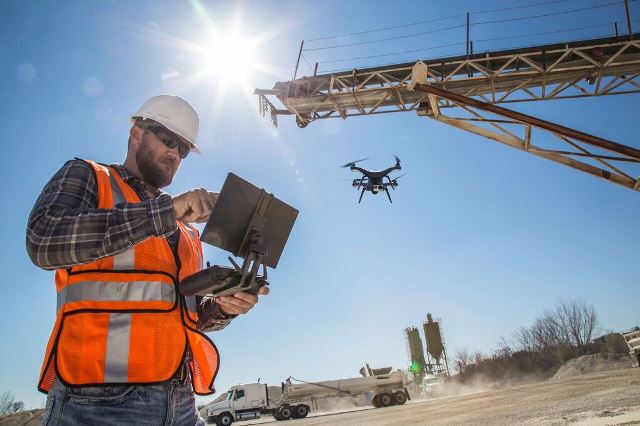
“We are now seeing more sophisticated surveying that entails use of aerial vehicles such as drones to do mapping. This technology has allowed timely completion of projects as well as enhancing cost efficiency,” says Dave Beattie Director of Autobuild Africa a survey equipment specialist based in South Africa.
With drone technology a single survey can do what used to take an entire team of people to accomplish.While GPS is used in a wide variety of industries, land surveyors were some of the first to take advantage of the technology.

Aerial land surveying in progress
GPS (Global Positioning System) is the name given to the satellites owned and maintained by the United States Department of Defence. There are now satellites belonging to Russia called Glonass, Europe called Galileo, and China called Bei Dou. The term used for the use of GPS plus one or more of these other systems is called GNSS.
Another technology that is now in use is LIDAR which enabled distances to be measured to any surface. This became an extra tool in total stations, then standalone terrestrial scanners, airborne scanners, and mobile scanners.
Nowadays LIDAR is combined with Photographic or imaging techniques and complete 3 dimensional models can be created with real colours.
However, the biggest challenge facing surveyors is keeping up with technology, and maintaining their relevance as many instruments are now so automatic that in some cases can be operated by untrained and unskilled operators, offers Mr Beattie.
And as surveys become more detailed and advanced techniques such as 3D modeling become commonplace, how we store data will become absolutely important.
It is therefore necessary to work with a service provider who offers an end-to-end data solution to ensure that stored data is secure and will be available when and where it’s needed.
Another piece of technology that has changed the profession is robotic total stations. These remote control devices allow surveyors to measure angles, distances, and more without traveling to each point themselves.
This can save time and money, and also cuts down on the amount of workers needed and the manual labor that the job typically requires.
Although technology has cut down on the need for workers in some industries, land surveyors are still in high demand. Smart, capable people who understand this technology and can use it to get the job done are always needed.
demand. Smart, capable people who understand this technology and can use it to get the job done are always needed.
“For many tasks, conventional surveying will still be needed. Even using the most advanced hi-tech equipment, trained surveyors are needed to ensure accuracy and standards are maintained,” notes Mr Beattie.
“But new instruments combining photography, Lidar, robotics, inertial sensors, angle sensors, are fast changing how surveyors work.”

